Description
Precision Survey Solutions are an approved CAA Operator of Unmanned Aerial Systems.
Using our experience and in depth knowledge of coordinate systems and measurement platforms, we have been able to seamlessly adopt the very latest in RTK UAS solutions into our surveying workflow.
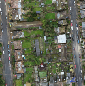
Utilising these latest high end mapping systems and professional photogrammetric reconstruction software, we are able to produce accurate data sets that can be integrated into any project workflow.
It is also important to understand that these systems require a quality assurance assessment that can be proven against known information.
Precision Survey Solutions do this by establishing a survey grade network of Ground control and verification points, that enable us, to assess the data we acquire using these aerial platforms, which is carried out using precise GPS and total station equipment.
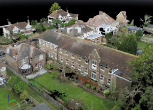
At Precision Survey Solutions, we operate multiple unmanned systems which allow us to provide many solutions such as Aerial Images and Video work, volumetric surveys, measured building models for heritage assessment, large scale topographic surveys and internal inspection work.
It is always important to consider safety when using UAS platforms, and at Precision Survey Solutions, safety is our number one priority, and in the interest of everyone we will always, if circumstances dictate, adopt a
NO FLY POLICY
Prior to every mission we will endeavour to identify all local hazards within the flight zone, establish any additional safety controls required and always fly within our CAA permission.

Gallery


If you would like a quotation, or wish to discuss our services, please call us or get in touch using the form below.
- +44 01273 568355
- +44 07968 532279
- sj@precisionsurveysolutions.com
- 181 Nevill Avenue, Hove, East Sussex, BN3 7NG

